For those contemplating a career in land surveying, you may be curious as to what the job involves. You will get the answer to your question ‘Is land surveying a good career choice?’.
These jobs appeal to many people because they allow them to work outside in a high-paying, non-labor-intensive position. Nobody wants to spend their days stuck in an office. This article will break down the cycle of a land surveyor and tell you the pros and cons of studying Landry surveying.
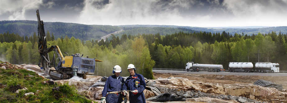
Land Surveying – What is it?
Surveying, at its most basic level, is the act of evaluating land. As a result of land sales, construction projects, or other reasons, boundary lines are often verified and certified.
Even though the word “land” is in the job description, surveyors also certify air and water boundary lines. Their work takes them all over — some of them remote — depending on where they function and what type of surveying the organization does for a living.
Having excellent analytical and arithmetic skills, as well as high attention to detail as well as excellent communication skills, will help you succeed as a land surveyor. Land surveyors ought to have vast experience in complicated measurement techniques, data analysis, and accurate recording of results to be successful in their field of work.
Below are the duties of a land surveyor:
- Create legal property boundaries compliance with legal actions and titles.
- The results of the study should be recorded, along with the property or feature’s shape, curvatures, position, altitude, and dimension.
- Be able to accurately predict terrain attributes such as terrain heights, deepest part, relative positions, and boundary lines.
- To accurately describe and accredit work performed, start preparing drawings, charts, and reports as well as legal characterizations.
- With the help of geodetic and technical devices, establish fixed locations that can be used in the creation of maps.
- In survey areas, use measuring devices to evaluate longitudes and latitudes of key aspects and boundary lines as well as satellite-based global positioning systems (GPS).
- Recruit and train a team of assistants and helpers, and supervise their work on tasks such as surveying or drafting maps
- Gather information on property borders by searching legal documents, survey records, and land titles.
- Correlate the findings from your research with the work of the project’s engineers or architects, clients, and other stakeholders.
- Research land surveying methodologies, utilizing techniques of photogrammetric maps collection and digital data handling.
- Identify and track and label geophysical prospecting locations, such as those used to search for oil and natural gas or other industrial minerals, to conduct geophysical prospecting operations.
- Enquire about navigable networks and gather data for breakwaters, piers, or any other marine structures that will be constructed in the future
- Aerial photography specifications and altitudes for photographing terrain should be determined.
Reasons why Land surveying is a good choice
Availability of jobs
Around 2,000 new surveying jobs will open up in the next few years. To fill just over half of the positions available, there aren’t enough students studying property and construction surveying. Students who choose to study surveying presently are practically assured a position at the end of their four-year program.
You earn better
This means that Chartered Surveyors earn on average $75,000 per year across the country. Property surveyors with up to 5 years of post-graduate experience in real estate and property maintenance earn an average of $35,200, excluding bonuses and benefits.
It is a traveling career
Certificated Surveyors can be found all over the world. Those who earn SCSI Chartered Membership can work on some of the world’s most exciting building projects in locations like the Mideast, Canada, and Australia. That’s good to know if you’re interested in a career that allows you to travel a lot.
… and it’s a hit at home too
The world faces a surveyor shortage, as we’ve previously discussed. As a result, the number of surveyors graduating is only half of what the world will need in the future. Those odds can be calculated by anyone, regardless of their math skills.
Versatility
As a surveyor, you’ll have plenty of opportunities to move among segments and change roles within them in the course of your career. Those who begin their careers in quantity surveying are not uncommon to move into managing projects after some time. Because of the high demand for these experiences and competencies, they are also highly portable. If you’re looking for a career with a lot of variety, surveying fits the bill.
Cutting edge
As part of surveying, you can study geomatics, which involves collecting and analyzing data about the earth’s surface and interpreting what it all means. There aren’t many technical skills that are more in demand than this one.
The ability to work with large multinationals
The US position as an entry point to EMEA marketplaces has enticed some of the world’s most well-known companies to our coasts. There are a number of these people who now own substantial real estate holdings, as well as land. Large multinationals such as Google and Facebook all have facility management workgroups and working with them not only looks good on your CV, but it can also lead to great travel benefits.
Work on developing an ideal professional career
Advantages for recent graduates range from quantity surveying to building surveying and contract management to geoscience. It’s possible to advance your career in surveying by working in a wide range of industries.
As a career, it’s ideal for women
This is no longer the case, as surveying used to be a male-dominated field. You’ll find women in all fields and at all stages of the career path. Their numbers will only significantly rise as more women realize that this is a field that offers good job opportunities, decent pay, and great satisfaction.
Using Land Surveying’s Tools
As a rule, surveying groups work together to evaluate angles and distances using tripods, levels, telescopic lenses and other measuring devices. Besides GPS devices, they could also use gauging straps and rims, drones, and total stations.
Survey work has existed for thousands of years, but recent technological developments have radically altered the field of work. For example, a geographic information system (GIS) is an advanced piece of technology that enhances 3D mapping. When working on projects where the terrain is heavily forested, this comes in handy. Planned developments may be significantly affected by tree density.
The 3-D laser scanner has revolutionized land surveying. There was once a time when a land surveyor could only measure with a traditional measuring tape. With the new laser scanners, the job time is cut in half and the accuracy is improved.
Land surveying has also been revolutionized by GPS technology. As a result of this technology, it is no longer required to get each depot within sight of the other. This implies that satellites can be accessed from any position on unblocked terrain as well as provide previously unattainable accuracy.
But when you’re out in the field and you see the limitations of the tools at hand, you realize that they aren’t omnipotent. Trees and buildings can cause modern tools to produce inaccurate results, so surveyors must rely on time-tested measurement instruments in these situations.
There is a wide range of technologies available to land surveyors today, such as laser technology, drones or advanced computing applications.
Types of land surveying Jobs
- Construction surveyors – construction surveys in addition to surveying land for property owners or developers Roads and buildings can be better planned with this information, as slope and grade of land can affect the degree of challenge, or even the possibility, for a certain construction project If the project involves a subterranean portion, they take into account factors such as soil type and the appearance of rock or streams.
- Experts in forensics– the legal system. A crime or accident scene can be reconstructed with the help of forensic investigators. Storm damage and environmental factors can also be assessed by them. These experts offer documentation to law enforcement, insurance firms, federal agencies, or other associated agents.
- A hydrographic surveyor– Land mostly around watercourses is surveyed. For example, you can map shorelines, riverbanks, and sea-floors in this way: For the Navy and other sailors, but also for development companies trying to plan riverfront initiatives or government entities building bridges, this information is vital
- Environmental surveyors- They map unused land in order to identify areas where endangered species live. Surveys may also be carried out in hazardous waste sites or areas that have been damaged by storms, flooding or fire.
Education
An undergraduate degree is not required to work as a land surveyor but it is beneficial. Land surveyors used to be trained on the job for many years. As a result, some formal training is extremely helpful and even needed in some jurisdictions because the innovation of the time was not nearly as refined as it is presently.
Science and technology, management and engineering, and strategic design planning are examples of bachelor’s degrees awarded by land surveyors. There are math and science requirements, including photogrammetry, satellite imagery, analysis techniques and modification, and geographic information systems (GIS) as well as other topics.
It is possible to earn an associate’s degree in surveying or a related field of study, such as mapping sciences or surveying technology. A large portion of the time spent in this degree program is spent outside the classroom learning how to draw maps and measure things as well as collecting and analyzing information.
The Accreditation Council for Engineering & Science necessitates consultants in many regions to have a degree from such a school. Applications and natural science courses in computer science, architecture or engineering technology are accredited by ABET at the associates’ bachelors’ and masters’ levels.
Land Surveyor Certification and Licensing Qualifications
In order to become a certified surveyor in your region, you must pass the Basics of Land survey assessment test, whether you have an associate’s degree or a bachelor’s degree. A surveyor’s work has been used in trials or documented on land deeds, so it’s important to get it right the first time.
If you’re not sure what your state’s requirements and licensing board are, check with your state’s licensing board before committing to fulfilling your duties.
However, some countries permit ambitious young land surveyors to forgo a college degree in favor of extra years of experience. If you were to work in this position, you would earn around $43,340 per year, or $20.84 an hour.
A state-specific assessment must be passed after completing the required number of years of schooling and the Theory and Practice of Surveying assessment test.
Are Land Surveyors Paid Enough Money?
On average, land surveyors earned $61,140 annually, or $29.40 an hour. In 2016, there were 44,800 people employed in the field. That’s faster than the average job growth rate of 7 % predicted by the BLS.
Each time you need to recertify your land surveyor permit, you will have to finish a certain amount in continuous learning. There are a variety of land surveyor continuing education classes available at different Academies. Although some of their courses are only two hours long, others can last up to 30 hours long. Make sure you are up-to-date on your state’s prerequisites for maintaining your land surveyor permit.
As an added convenience, PDH Academy offers class bundles to help you save even more money. We offer three different bundles — A, B, and C — each of which provides 16 hours of continuing education. For example, in Bundle A, you’ll find three classes: Specs for Land Characterization; Rectangular Survey Method; Placeholder Underlying Principles of Land Ownership and Limits. There are four courses in Bundle B: Planning and Preparation Civil Works Observations, Survey Indicators,, Corner Restoration Underlying principles, and Building projects Surveying — Curves.
Challenges
There are difficulties in every career, and land surveying is no exception. Various problems arise daily, and they do not often respond to simple fixes. The career path indeed faces a few difficulties that are frequent to all.
Below are few challenges faced by land surveyors:
- Time
- Weather and season
- GIS frameworks
- Paper streets / adverse possession
- Incomplete laws